|
Synopsis: |
|
So I've lived in the fine city of Montreal for the better part of a year now and yet far
too many people don't know what it's like around here. So I thought I'd snap some photos
around my neighborhood to give anyone who's interested a feel of what it's like where I
live. So... I live in the area known as "The Plateau", right smack dab in the center of
the city. This is a thriving area with a lot of restaurants and bars and shops and things;
it's sort of the equivalent of Greenwich Village in New York. McGill is *directly* in the city
center, sandwiched in between downtown and Mont Royal, the city's resident mountain. I
live about a twenty minute walk from McGill. So these pictures are clustered in two areas:
around my apartment and around McGill. There are also a couple of shots on the walk between
the two (the walk I do every day), and two from the observation deck on Mont Royal. You've
got two options for how to see them: take a "virtual" tour via the slideshow, or click on
the map to view the locations you want. Enjoy. And come visit and see yourself! :)
(oh, for NY buffs: Mont Royal is a parkland that was designed by Frederick Olmstead, the same person who designed Central Park in New York City)
|


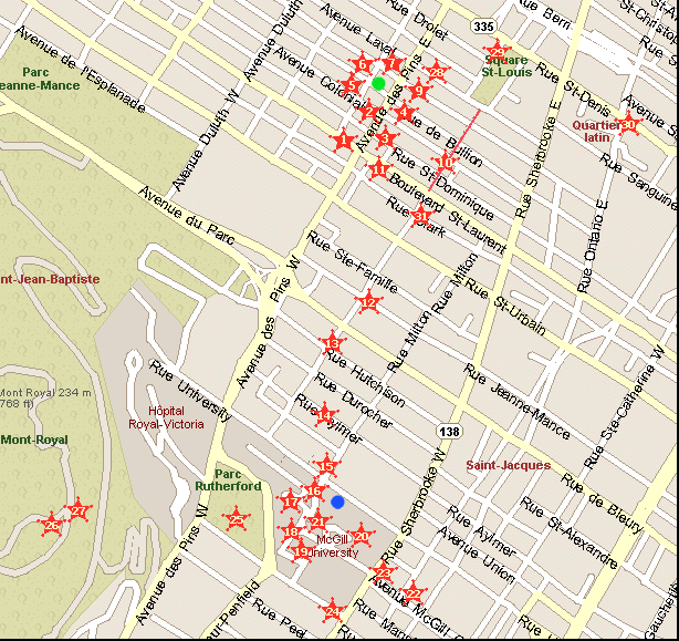
 = my apartment (on Avenue Hotel-de-Ville, which
runs parallel to and one down from Laval) between Avenue des Pins and Roy.
= my apartment (on Avenue Hotel-de-Ville, which
runs parallel to and one down from Laval) between Avenue des Pins and Roy. = my building at McGill (where
my office is)
= my building at McGill (where
my office is)